
from New York Times
Analysing digital streams of information from electric scooters and motor-assisted bicycles are helping solve travel congestion issues.
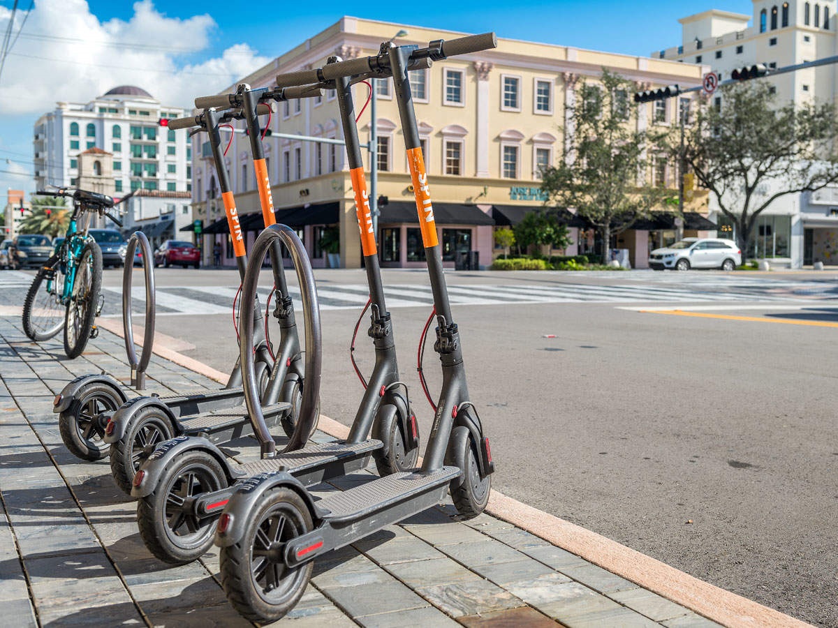
Five seconds after a Los Angeles rider unlocks a dockless electric scooter with a smartphone app and sets off to a destination, a cityoperated databank is informed.
Five seconds after the trip ends, typically no more than a mile away, another alert updates the record, noting the location. In 24 hours, the exact route is uploaded and logged for analysis.
That ride to the bus stop or the convenience store, emissions-free and nearly silent, would seem to be a zero-disruption event in a sprawling city with millions of people and vehicles. Yet extrapolated over years, it foreshadows a shift of potentially enormous consequences.
While the identity of that rider is unknown to the city, a stream of data from the scooter’s GPS module and cellphone link — speed, time of day, battery state of charge — flows to cloud servers an average of a million times a month during Los Angeles’s pilot program. Each trip is but a trickle of bytes, yet it is a rich resource for the planners and the policymakers who hope to tame the persistent tangle of traffic in this vehicle-dependent metropolis.
That vehicular chokehold can weigh as heavily on a neighborhood dweller as it does on a road user. “Cities have to assure that their resources are used efficiently, and that includes the shared spaces,” said Stephen Zoepf, chief of policy development at Ellis & Associates, a Silicon Valley consultancy that helps cities develop transportation technology plans.
“The effects of crowding, in noise and emissions, are a tragedy of the commons,” he continued, using an economist’s term for situations in which resources are depleted by those acting in self-interest rather than the general good.
The arrival of electric scooters and motor-assisted bicycles, backbones of a transportation mode known as micromobility, has been greeted as part of the solution to clogged roadways and unbearable travel delays. There’s a business opportunity as well, with a projection of a micromobility market valued at up to $15 billion annually in the United States and Europe by 2025, according to a study by the Boston Consulting Group.
The urgency to sort out the conflict between vehicles and road space is growing. About 55 percent of the world’s population lives in urban areas, according to the United Nations; by 2050, that share is projected at 68 percent. Cities, already teeming, are increasingly frustrating to get around.
Yet the route to clearing the congestion has been a highway paved with obstacles. Linking transportation hubs to housing in the affordable last mile, where the need is greatest, proves a hurdle too high. Getting people out of their cars is a vexing problem; delivering goods without bulky trucks is nearly impossible.
Seleta Reynolds, general manager of the Los Angeles Department of Transportation since 2014, is an eyewitness to monumental shifts in transportation, her job expanding from oversight of city functions like parking and public transit to coping with the onset of digital platforms for hailing rides.
“What became clear to me was that the digital version was going away from public management of the right of way,” she said in a telephone interview, referring to innovations like Uber and Lyft, which arrived in Los Angeles without regulations in place for driver pay, working hours or background checks.
Zoepf said cities were caught by surprise. “Now we had companies supported by venture capital saying, ‘We’re not providing transportation, we’re platforms,’ and doing business on the public right of way without a permit arrangement,” he said. But a greater upheaval lay ahead.
“Then scooters showed up,”Reynolds said, noting that Los Angeles was unprepared for the 2017 arrival of easy-toride, motorized upgrades to what were once deemed children’s toys. “We got caught flat-footed in the transformation.”
In part, the solution to this cat-herding problem lay in making use of the data generated by the dockless scooters for fleet owners, who need to know where the scooters are in order to gather them each night for battery charging and reposition them the next morning where demand will be greatest.
That data set is also a key to solving congestion: Knowing what route they have used historically makes it possible for policymakers to plan infrastructure. The ability to monitor their every movement is no longer alarming to users — privacy is a serious concern, but not a showstopper, given that our smartphones already feed generous helpings to any number of data-digesting apps.
To collect the digital stream in a form useful to all, the Mobility Data Specification, or MDS, was created by the Los Angeles transportation department.
As an open-source software platform built on a set of application programming interfaces — the communication protocols between parts of a computer program — MDS is now used by more than 50 American cities and dozens more around the globe. It is governed by the Open Mobility Foundation, chaired by Reynolds.
MDS IN USE
Hoboken, New Jersey, could serve as the ideal petri dish for testing micromobility. A mile square, with 55,000 residents and little elevation change, it is home to thousands of commuters who connect to buses, trains and ferries that will carry them to workplaces in Manhattan, across the Hudson River. Hoboken’s escooter pilot also fit perfectly with sustainability goals.